ENGINEERING HYDROLOGY: CHAPTER 051 - SCALE IN FLOOD HYDROLOGY
1. MIDSIZE CATCHMENTS
1.01
Catchments possessing some or all of the following properties are midsize in a hydrologic sense:
- rainfall intensity varies temporally within the storm duration
- rainfall can be assumed to be uniformly distributed in space
- storm duration is usually shorter than time of concentration
- runoff is by overland flow and stream channel flow
- channel storage processes are small
1.02
The catchment response of midsize catchments is described by methods that take explicit account of the temporal variation of rainfall intensity.
1.03
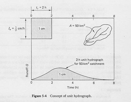
The most widely used method to accomplish this is the unit hydrograph.
1.04
In the unit hydrograph, a hydrograph for a unit storm is derived and used as a building block to develop the composite or flood hydrograph.
1.05

1.06
Midsize catchment analysis assumes a uniform spatial distribution of rainfall.
1.07
This assumption allows the use of a lumped method such as the unit hydrograph.
2. LARGE CATCHMENTS
2.01
For large catchments, rainfall is likely to vary spatially.
2.02
Therefore, large catchments cannot be analyzed solely with a lumped method such as the unit hydrograph.
2.03
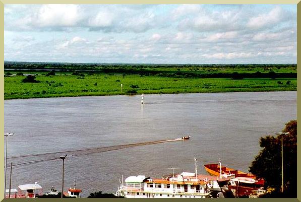
Also, large catchments feature large rivers, which usually have mild gradients.
2.04

Upper Paraguay river at Corumba, Brazil.
2.05
Mild gradients lead to runoff diffusion and, consequently, to channel storage.
2.06
Therefore, large catchments have a substantial capability for longitudinal channel storage.
2.07
For large catchments, it is necessary to use distributed catchment modeling, coupled with channel routing.
3. SCALE LIMITS
3.01
The upper limit of a midsize catchment is somewhat arbitrary.
3.02
Values between 1000 sq km (400 sq mi) to 5000 sq km (2000 sq mi) have been used to describe the upper limit of a midsize catchment.
3.03
There is no consensus to date, but the current trend is toward the lower limit.
3.04
Note that there is a range of sizes for which the catchment could be construed as either midsize or large.
3.05
The larger the catchment, the less likely it is that lumping will provide the necessary spatial definition.
3.06
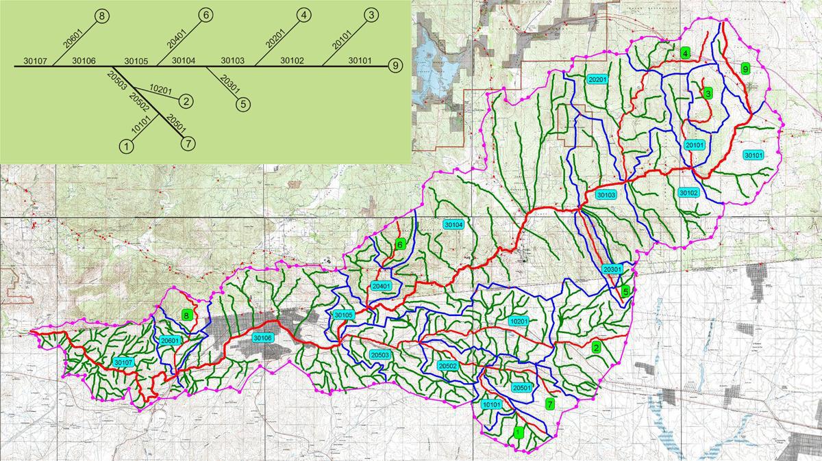
A large catchment can be viewed as a collection of midzise subcatchments.
3.07
Unit hydrograph techniques can be used to generate flood hydrographs for the individual midsize subcatchments.
3.08

Campo-Tecate watershed, U.S.-Mexico border, California.
3.09
Among the distributed models in current use are: HEC-HMS, TR-20, HSP-F, SWMM, SSARR, and Sacramento.
3.10
Distributed models include (a) rainfall depth-area reduction, (b) hydrologic abstraction,
(c) conversion of effective rainfall to runoff, and (d) reservoir and channel routing.
3.11
Routing calculates precisely the movement of the flood wave.
3.12
Routing is not restricted to large catchments.
3.13
It can be used for small and midzise catchments if data availability and the need for greater accuracy warrant more precise calculations.
Narrator: Victor M. Ponce
Music: Fernando Oñate
Editor: Flor Pérez
Copyright © 2011
Visualab Productions
All rights reserved


