Dr. Victor Miguel Ponce
100413 10:00; revised 101016 20:00

TASKS:
- Secure the 65-yr flow series on the Tijuana river basin at entrance to the U.S. (Parra).
- Secure the basin area for the Tijuana river basin 60-yr flow series (Parra).
- Determine the basin area for the El Barbon-Guadalupe river basin at two locations (IMIP/Zuñiga):
- Mouth of Cañon Hondo, and
- Cañon Santa Rosa I.
- Correlate the TRB-EBGRB data (find the ratio of drainage areas, and apply to the series) (SDSU).
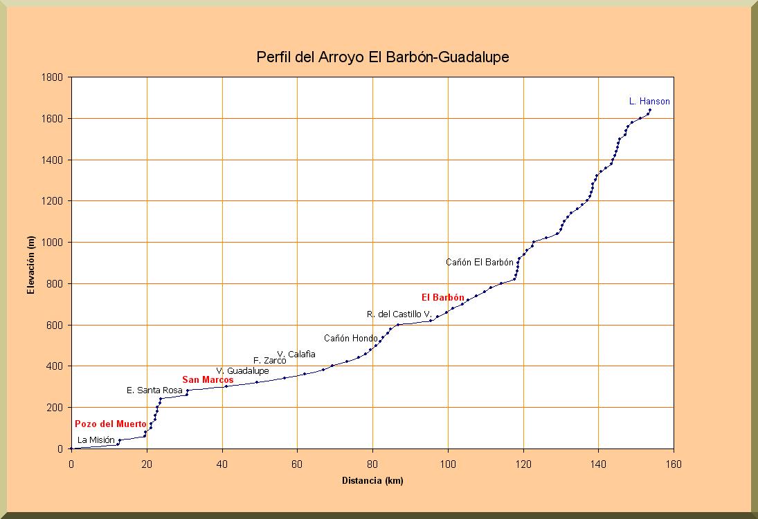
- Develop an updated profile of the study reach, between mouth of Canon Hondo and Cañon Santa Rosa I (approximately 42 km) (SDSU).
- Field Survey No. 1: Estimate channel width and side slopes in study reach (21 locations, that is, approximately every 2 km) (IMIP-SDSU).
- Determine the variation of bottom slope along the study reach (20 bottom slopes) (SDSU).
- Field Survey No. 2: Sample the creek bottom to determine mean size diameter of sand (21 values) (IMIP-SDSU).
- Perform lab analysis to calculate mean diameter (21 values, SDSU).
- Field Survey No. 3: Estimate Manning's n in the study reach (20 values) (SDSU).
- Run sediment routing model to determine amounts of deposition per reach, per series (SDSU).
- Integrate the results into a volume per study reach (million cubic meters) per 60-yr flow series (SDSU).
- Other aspects of the study (IMIP/Zuñiga).
- Write a report detailing findings (SDSU-IMIP).
- Post report on the web (SDSU).