Using USGS to located a discharge station in U.S.
- Go to USGS web page: https://maps.waterdata.usgs.gov/mapper/index.html
- Click inside the map and zoom in to indentificate one discharge station.
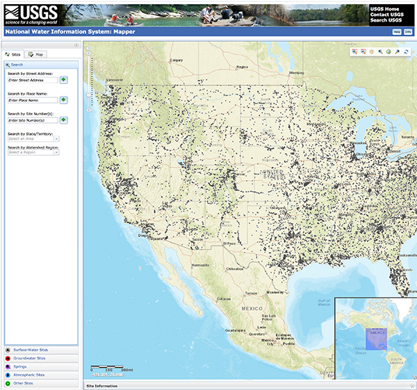
Fig. 1 USGS virtual plataform: National Water Information System.
- Identicate the discharge station and clic on the grey icon.
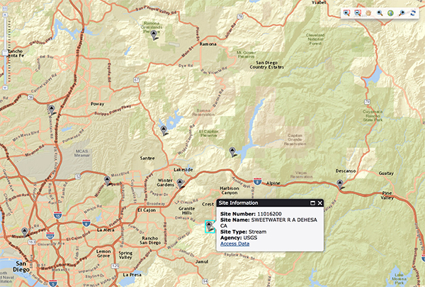
Fig. 2 View of the information of discharge station.

Fig. 3 View of the station name and code.
- Clic on Access Data. Then chose the type of discharge data that we need.
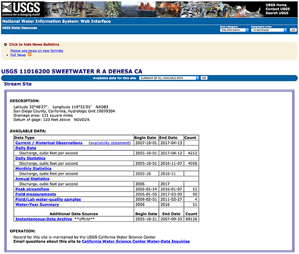
Fig. 4 View of available data from discharge station.
- Click on Daily Data.
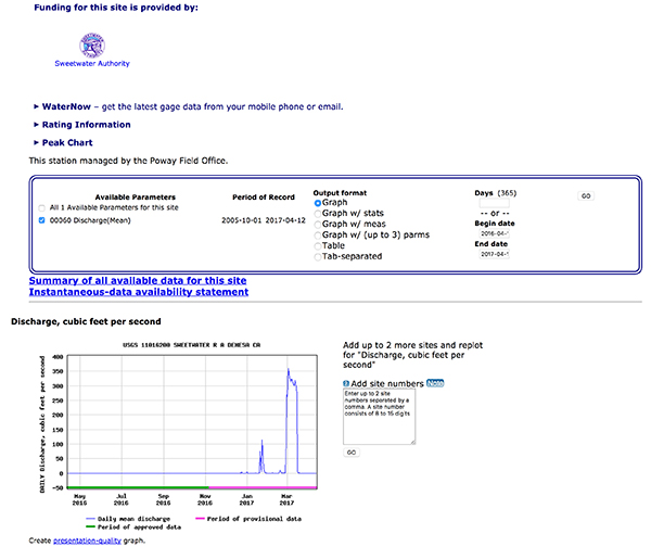
Fig. 5 View of available parameters selected.
- Chose between Graph or Table the ouput data format and input date range
(begin and end). Finally clic onGo.

Fig. 6 View of graph selected discharge data.
- View of the previsualization graph.
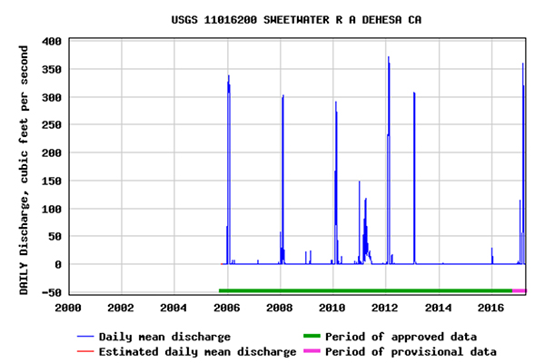
Fig. 7 View of previsualization graph.
- View of Table output data.
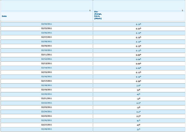
Fig. 8 View of tabla data.