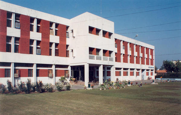
of the National Institute of Hydrology, Roorkee, India
Consultant to the World Bank
1. INTRODUCTION
This Interim Report: Benchmarking Exercise - Task A is submitted in compliance with the requirements
of the contract between the Consultant and the World Bank, in reference
to the project entitled: "Benchmarking, Technological Upgradation and Capacity Building Programme of the
National Institute of Hydrology, Roorkee, India". Hereafter, the term
NIH refers to the National Institute
of Hydrology, Roorkee, India.
This report details the accomplishments to satisfy Task A of the Terms of Reference:
The report prepared by NIH staff entitled: "Current Status and Working of
National Institute of Hydrology" constitutes the baseline document for the benchmarking, upgrading, and capacity building exercise
(National Institute of Hydrology, 2012).
Its Section 8 entitled: "Benchmarking and Technological Upgradation of NIH Including
Capacity Building" forms an integral part of the current project.
2. BENCHMARKING OF NIH
According to the Terms of Reference, the following activities are to be accomplished as part of Task A:
In the Inception Report (Ponce, 2012a), the Consultant has detailed his approach to accomplish the objectives of the benchmarking exercise.
The exercise consists of two components:
Peer benchmarking seeks to develop an international benchmark
and measure NIH goals, activities and accomplishments against this
benchmark. Content benchmarking
seeks to determine the extent to which NIH activities and accomplishments satisfy widely recognized hydrology fields and content standards.
3. NATIONAL INSTITUTE OF HYDROLOGY
The National Institute of Hydrology, Roorkee, India, was established in 1978 as an autonomous organization under the Ministry of Water Resources, Government of India.
NIH's mission
is to research and develop world-class knowledge and expertise in the hydrological sciences.
The institute carries out basic, applied, and strategic research in hydrology and water resources.
It aims to develop methodologies for the optimum utilization of water resources,
to develop methodologies for water and environmental sustainability, to propagate emerging technologies in water resources development,
to save society from water related hazards, and to develop mass awareness for water conservation and optimum utilization.
NIH operates through five scientific divisions:
The Environmental Hydrology division performs research and development in the following areas: (1) Surface, ground, and wastewater
quality monitoring and modeling; (2) contaminant transport modeling; (3) lake ecosystems; (4) erosion
and sedimentation; (5) point and non-point source pollution; (6) low-cost treatment and remedial technologies; (7) environmental
impact assessment; and (8) environmental flow requirements. The division features a well equipped Water Quality laboratory,
with facilities and equipment for the analysis of water samples.
The Groundwater Hydrology division performs research and development in the following areas:
(1) Aquifer parameter estimation; (2) aquifer response to untoward stresses; (3) groundwater assessment, modeling,
and management; (4) coastal groundwater dynamics; (5) contaminant transport modeling;
(6) groundwater recharge, and (7) impact of climate change on groundwater resources. The division features a Numerical Groundwater Modeling
laboratory, with advanced computational facilities and technologies for groundwater assessment, modeling, and management.
The Hydrological Investigations division performs research and development in the following areas:
(1) Surface and groundwater interaction;
(2) groundwater recharge due to rain and irrigation;
(3) identification of recharge zones in springs and rejuvenation of springs;
(4) lake studies;
(5) aquifer dynamics;
(6) seawater intrusion; and
(7) effectiveness of artificial recharge.
The division operates two laboratories: (1) Nuclear Hydrology Laboratory, and (2) Hydrological Instrumentation Laboratory.
The Nuclear Hydrology laboratory features facilities and equipment to measure various types of radioactive and stable isotopes.
The Hydrological Instrumentation laboratory features facilities and equipment for
the measurement and demonstration of hydrometeorological parameters.
The Surface Water Hydrology division performs research and development in the following areas:
(1) Water availability, flow duration, and environmental flow requirements;
(2) hydrological modeling;
(3) flood estimation;
(4) flood routing;
(5) structural and nonstructural flood management;
(6) watershed management for flood control;
(7) sedimentation studies for flood control;
(8) socioeconomic aspects of flood disasters;
(9) urban hydrology;
(10) drought hydrology and management; and
(11) impact of climate change on water resources.
The division has a Soil and Water laboratory, featuring facilities and equipment to measure soil moisture, particle size,
infiltration rate, and other soil properties. In addition, the division has a Snow and Glacier laboratory, with
a glaciological research exhibition
facility, mountaineering equipment, hydrological instruments, sediment samples, and related pictorial displays, and
a Hydrometeorological Observatory.
The Water Resources Systems division performs research and development in the following areas:
(1) decision-support systems for integrated river basin planning and management;
(2) reservoir operation;
(3) irrigation systems;
(4) river basin planning;
(5) hydrological predictions in ungaged basins; and
(6) soft-computing techniques such as artificial neural networks, genetic algorithms, and fuzzy logic models,
for the analysis of water resources systems. The division operates a Remote Sensing laboratory, with facilities
and equipment to apply remote sensing and GIS tools for the solution of diverse water resources problems.
In addition to its divisions and laboratories, NIH has a Research Coordination and Management Unit (RCMU)
which coordinates research activities and networking with other national and international organizations.
RCMU focuses on lectures, publications, capacity building programmes, the NIH newsletter, promotion of international cooperation,
facilitation of technology commercialization, and other dissemination tasks.
To facilitate its regional activities across India, NIH has four regional centres and two centres for flood management studies, as follows:
4. PEER BENCHMARKING
To accomplish Peer Benchmarking, the Consultant has reviewed
data on institutes of hydrology in more than twenty countries around the world (see Inception Report).
In selecting a reduced set for further analysis, the Consultant used the following
criteria to be met by a candidate country/agency:
Benchmarking is defined as a systematic process for evaluating the operations of organizations
that are recognized as representing best practices, for the purpose of organizational improvement (Spendolini, 1992).
The Peer Benchmarking Data shown in
Appendix A
is used to develop a framework for analysis. This data constitutes the basis of the
Peer Benchmarking Matrix (PBM), shown in
Appendix B.
The PBM lists ten (10) institutes, with location, status, mandate, emphasis, and activities.
The following countries are listed, in alphabetical order: Australia, Canada, China, Egypt,
Iran, Japan, Mexico, New Zealand, Russia, and the United Kingdom.
For comparison, the PBM also lists NIH data,
detailed in Section 3 of this report.
4.1 Evolution in Water Science
On a global basis,
the field of water science has undergone an evolution in name and emphasis over the past several decades (see box below).
Chronologically, the first water institutes were primarily
focused on hydraulics, as shown by the examples of China's Tianjin Hydraulic Laboratory (established in 1933; renamed in 1935)
and the United Kingdom's Hydraulics Research Station (1951), a
predecessor of its Institute of Hydrology (1965)
(Appendix A).
The exception is Russia, whose State Hydrological Institute dates back to 1919.
Through the 1960s and 1970s, the emphasis gradually shifted to hydrology; for example, the
United Kingdom's Institute of Hydrology (1965) and India's National Institute of Hydrology (1978);
and some time later, to water resources, as in China's Institute of Water Resources and Hydropower Research (1994). Through the 1980s and 1990s,
the emphasis shifted again, this time to water as an all encompassing field,
as shown by the examples of Mexico's Institute of Water Technology (1986) and Egypt's National Water Research Centre (1994). The most recent trend is a shift to a concentration in ecohydrology,
as shown by the transformation of the United Kingdom's Institute of Hydrology into
the Centre for Ecology and Hydrology (1994).
Hydraulics (1950s)
The field of water science and engineering
as it relates to the studies for the
construction of dams, canals, and other structures for the storage of water and its conveyance
from a place of supply to a place of demand. The focus of hydraulics is usually on a structure or structures
to be built in a certain location.
Hydrology (1960s)
The field of hydrologic science and technology
as it relates to the
study of the hydrologic cycle, including surface water, groundwater, water balance, and water availability.
Typically, hydrology uses the catchment as its unit of analysis;
therefore, it is much broader than hydraulics. Water Resources (1970s)
The field of water as a resource, principally for human use,
based on hydrologic science and drawing heavily from it,
while encompassing broader topics such as systems, management, socioeconomic aspects, and other related subjects.
Thus, water resources is broader than hydrology. Water (1980s)
The field of water in general, when considered for all uses and users, including both human and ecosystems,
and encompassing the entire gamut of knowledge fields, including hydraulics,
hydrology, water resources, biology, ecology, environmental science, economics,
sociology, institutional aspects, and law.
Thus, water is broader than water resources. Ecohydrology (1990s)
A specialized field of hydrology that focuses
on the interactions between water and the water cycle with the surrounding ecosystems.
Ecohydrology is an emerging field, narrower in scope than water.
4.2 Naming a National Institute
The question of what to call a national water research institute has no definite
answer at this time.
However, a careful analysis of the PBM
(Appendix B)
reveals some clear patterns.
For most countries, hydraulics ceased to be a central theme over the years, as the emphasis
shifted gradually to the broader issues of hydrology and the environment.
Of the eleven countries listed in the PBM, only one (Japan) still operates a primarily hydraulic agency,
notably, with the name Japan Water Agency. Two countries (Russia and India) consider
hydrology as the central theme of their operations. Two other countries (China and New Zealand)
specifically mention Water Resources in their national institutes' names. Five countries
(Australia, Canada, Egypt,
Iran, and Mexico) have chosen to highlight Water in their institutes' names.
One country (the United Kingdom) has relatively recently (1994) shifted its emphasis from hydrology to ecology and hydrology.
In the 1960s and 1970s, with the advent of the environmental revolution,
countries began to shift their focus from the
single-minded pursuit of economic development to the much broader
endeavor of environmental protection and natural
resource
conservation.
At the same time, the focus shifted from industrial and other
forms of pollution to materials recycling and pollution
prevention and control. Gradually, water was recognized as a most precious resource, which led to
the establishment of the national water research institutes (Appendix A).
The gradual shift in emphasis from hydraulics to water resources followed naturally from the recognition
of water as the all-encompassing natural resource. What had originally been a narrow field focused on water
utilization for human benefit (hydraulics), evolved into the
broader field of hydrologic science, with the main focus on the understanding of the water cycle.
Interaction with other societal
components, including ecology and economics, eventually demanded an even broader context. Thus,
the advent of water resources, and eventually, simply water, as the problems
were recognized to encompass the entire field of human knowledge.
Global trends now point to Water as the name of choice for a national water institute; for example, Australia's
CSIRO Land and Water, Mexico's Institute of Water Technology, and a host of other institutes
(see Appendix B). In the current era, with inclusion recognized by most as the preferred strategy,
the term Hydrology [by itself] is increasingly being
perceived as somewhat dated. Therefore, the Consultant recommends
that NIH consider eventually making the shift to redefining/renaming itself as National Water Institute, or else, National Water Research Institute,
in line with global trends.
4.3 Peer benchmarking and content
A careful analysis of the Peer Benchmarking Data
(Appendix A) and the
Peer Benchmarking Matrix (Appendix B)
leads to the following observations, classified as to theme, technical scope, and ancillary activities:
The selected
benchmark comparison institutions differ widely
in their chosen theme of emphasis. One country caters almost exclusively to hydraulics (Japan), yet most others emphasize either
hydrology (Russia), water resources (China, New Zealand), water research (Egypt, Iran), or
water (Australia, Mexico).
One country (the United Kingdom) has gone as far as to replace its hydrology institute for a Centre for Ecology and Hydrology,
in line with the perceived need for a multidisciplinary approach to these two fundamental sciences.
The selected benchmark comparison institutions differ widely in their technical coverage of the
various water fields. Some institutions have chosen to concentrate on a few selected fields, presumably, those
where their expertise would be subject to little challenge.
For example, Canada's National Hydrology Research Centre focuses somewhat narrowly on biogeochemistry,
GIS applications, computer modeling, and isotope research.
Others, such as Russia's State Hydrological Institute, run the gamut of traditional water fields,
including hydrology, meteorology, river mechanics,
water resources,
water management, hydrologic modeling, hydrologic instrumentation, hydroecology, and climate change.
The selected
benchmark comparison institutions differ widely in their dedication to
ancillary activities.
Some institutions are heavily engaged in training, capacity building, and
dissemination of information, at various levels and for diverse audiences;
for instance, Russia's State Hydrological Institute, Mexico's Institute of Water Technology, New Zealand's National Centre for Water Resources,
and Egypt's National Water Research Centre.
Others manage to cover the history of water resources; for instance, China's Institute of Water Resources and Hydropower.
4.4 Peer benchmarking and current trends
The benchmarking exercise has led to the identification of the following trends:
Water is a dynamic, rather than a static field.
Over the past several decades, changes have occurred
that reflect the evolution of society and scientific thinking.
There has been a shift in focus, and new themes
have emerged. Moreover, most countries have recognized and endorsed the
multidisciplinary and interdisciplinary nature of water.
Ecohydrology, an emerging water science, is now being covered by several institutes
around the world. Examples are the use of
hydrobiology (Mexico), hydroecology (Russia), and ecology and hydrology (United Kingdom).
The rationale is that plants and water are intertwined in Nature, and their division into
separate fields is deemed to be largely arbitrary. In the wake of the environmental revolution, ecohydrology emerges
with the recognition that water and plants are indeed inseparable. Meinzer (1927),
who wrote the early treatise "Plants an indicators of ground water," was clearly ahead of his time.
There is a perceived trend for a better understanding
of wetlands, where hydrophytes and hygrophytes are the rule rather than the exception.
Several water institutes around the world are
now covering the fields of aquatic biology (Australia), hydrochemistry (Mexico), biogeochemistry (Canada),
and biodiversity and ecosystem services (United Kingdom).
The recognition of the importance of biogeochemistry follows the
seminal work of Vernadsky (1926), who was among the first to recognize the
interrelation between geosphere and biosphere, and Nature's logical transition to the noosphere.
Soil, water and plants are intrinsically related;
thus, the case is made for the interdisciplinary science of wetland hydrology.
In these contemporary times, hydrology is reaching beyond, to encompass the whole of human society,
in practice fully realizing Vernadsky's dream of the noosphere.
In addition to the ecological aspects,
it has now become necessary to include economic, socioeconomic, institutional and
political aspects in water resources studies. For instance, environmental impact
methodologies purposely include social and other related aspects; see, for instance,
Leopold et al. (1971) and Dee et al. (1973).
Thus, the case is made for socioeconomic hydrology as an emerging water field.
4.5 Peer benchmarking and NIH
The question of how NIH rates with respect to the benchmark comparison institutions
is addressed here.
In the Consultant's judgement, NIH stands in a preeminent position in many areas,
as the Baseline Document for this benchmark project clearly shows (National Institute of Hydrology, 2012).
The technologies and techniques developed at NIH through its 34-year existence cover a wide range of applications
in hydrological science.
In intensity and extent of coverage,
only Russia's State Hydrological Institute and Mexico's Institute of Water Technology
stand as peers to NIH (Note that both of these institutions have extensive staff,
approximating 300 scientists;
see Appendix A).
In several areas, current levels of expertise at NIH
match those
of the best institutes in the benchmark group,
certainly in quantity [if not in quality].
This is the case in each one of NIH divisions: surface water hydrology, groundwater hydrology,
environmental hydrology, experimental hydrology, and water resources systems.
Notable accomplishments are being made in flood hydrology, catchment hydrology, snow and glacier hydrology, reservoir hydrology,
drought hydrology, groundwater modeling, water quality modeling, decision-support water resources systems, nuclear hydrology,
remote sensing and GIS applications, and other fields.
Specific gaps in research have been identified in Section 7 of the Baseline Document (National Institute of Hydrology, 2012).
These gaps remain to be addressed in Task B of the benchmarking exercise.
Training and capacity building, considered to be an intrinsic component of the benchmarking exercise,
should assure the continuance of NIH's excellence in the various water fields.
Renewed efforts are required in the emerging field
of Ecohydrology
to eventually match progressive developments in countries such as the United Kingdom.
Definite inroads onto Online hydrology are
generally being made by most comparison institutions.
By most standards, countries such as Australia, Canada, and the United Kingdom have an effective online presence.
Other listed countries have yet to make
significant progress.
To achieve, maintain, and eventually exceed parity,
a sustained emphasis in
Online hydrology is needed at NIH.
5. CONTENT BENCHMARKING
To accomplish the Content Benchmarking, the Consultant has identified one-hundred (100) Facets of Hydrology,
interpreted as fields of study
related to the hydrological sciences (Ponce and Palaniappan, 2012).
The Facets document is a comprehensive list of hydrology subfields.
During the first field visit (11-22 May 2012), the Consultant worked closely with NIH staff to
develop a Content Benchmarking Matrix (CBM), shown in Appendix C.
This matrix shows the extent to which NIH activities and accomplishments fulfill the fields listed in the Facets
(Ponce, 2012b).
The CBM lists the one-hundred facets of hydrology, and proceeds to determine two indices:
The intensity of coverage index indicates the following:
The developed CBM shows the following coverage indices for the various fields:
Surface-water, groundwater, flood, regional,
catchment/basin/watershed, deterministic, numerical, applied, scientific, computational, spatial, water-quality, and
contaminant hydrology.
Agricultural, urban, glacier, hard-rock, coastal/deltaic, parametric, conceptual, analytical, theoretical, kinematic, dynamic, systems, field, soft-computing,
environmental, reservoir, nuclear, geohydrology, mesoscale, hydroinformatics, and fluvial geomorphology.
Vadose-zone, drought, yield, arid-land, tropical, forest, snow, mountain, alluvial-fan, floodplain, stream, lake, estuarine, endorheic, stochastic, statistical, experimental,
engineering, synthetic, physical, operational, drainage, hydrogeology, hydrometeorology, hydroclimatology, and hydrochemistry.
Baseflow, low-flow, rural, mining, road/bridge, military, political, hydrogeography, and deltaic geomorphology.
Rangeland, wildland, hillslope, karst, wetland, online, historical, ecohydrology, paleohydrology, hydrosedimentology, hydrobiology, sediment-transport technology, and water law.
Nordic, polar, peatland, island, global, prairie-pothole, navigational, economic, socioeconomic, archaeological, medical, forensic, transboundary,
space, microscale, hydroecology, hydroarchaeology, and potamology.
The emphasis index indicates the following:
The developed CBM shows the following emphasis indices for the various fields:
Drought, baseflow, low-flow, arid-land, urban, rural, mountain, hard-rock, wetland, island, experimental, online, mining, nuclear, economic, socioeconomic,
ecohydrology, hydrosedimentology, and sediment-transport technology.
Surface-water, groundwater, vadose-zone, flood, yield, tropical, forest, rangeland, wildland, agricultural, regional, catchment/basin/watershed,
snow, glacier, hillslope, karst, alluvial-fan, floodplain, stream, lake, coastal-deltaic, estuarine, endorheic, deterministic, stochastic, statistical, parametric, conceptual, analytical, numerical,
theoretical, applied, scientific, engineering, computational, synthetic, kinematic, dynamic, physical, spatial, systems, field, operational, soft-computing, environmental, water-quality, contaminant,
drainage, reservoir, road/bridge, navigational, military, historical, archaeological, political, forensic, geohydrology, paleohydrology, transboundary, mesoscale, hydrogeology, hydrometeorology, hydroclimatology, hydrochemistry,
hydrobiology, hydrogeography, hydroinformatics, fluvial geomorphology, deltaic geomorphology, potamology, and water law.
[None listed].
Nordic, polar, peatland, global, prairie-pothole, medical, space, microscale, hydroecology, and hydroarchaeology,
Columns 13 and 14 of the CBM show the NIH division(s) and regional centre(s) that
cover each of the respective fields, respectively.
5.1 Emerging Areas
The CBM serves the purpose of identifying new and/or emerging areas of research.
The CBM indicates that fields with
coverage index C ≤ 1 are not being intensively covered by NIH.
In addition, fields with emphasis index E = 3 have been identified for increased emphasis.
The CBM shows the following fields with coverage index
1. Wetland hydrology
2. Island hydrology
3. Online hydrology
4. Economic hydrology 5. Socioeconomic hydrology
6. Ecohydrology
7. Hydrosedimentology
8. Sediment-transport technology
Wetland hydrology has taken on a new importance after the recognition
by many countries of the role of wetlands in ecosystem function and balance.
Wetlands are no longer necessarily earmarked for drainage, as was the practice in the past. For the past two decades,
the trend has been to protect wetlands
(Mitsch and Gosselink, 2011). The philosophy is
embodied in the principle of no net loss of wetlands. This gives rise to the emerging field of wetland hydrology,
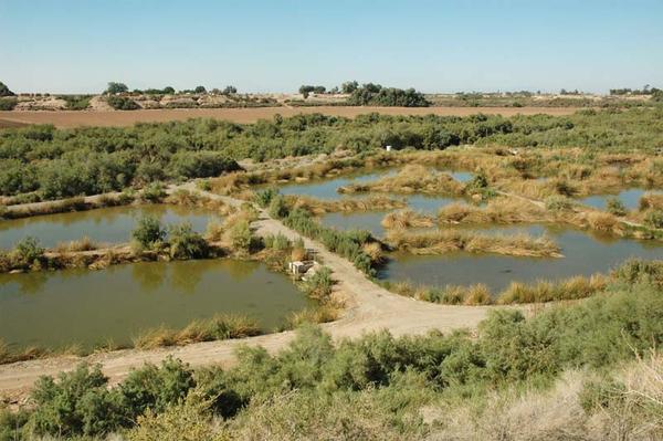
which studies wetland processes and functioning, wetland conservation and preservation, and design of
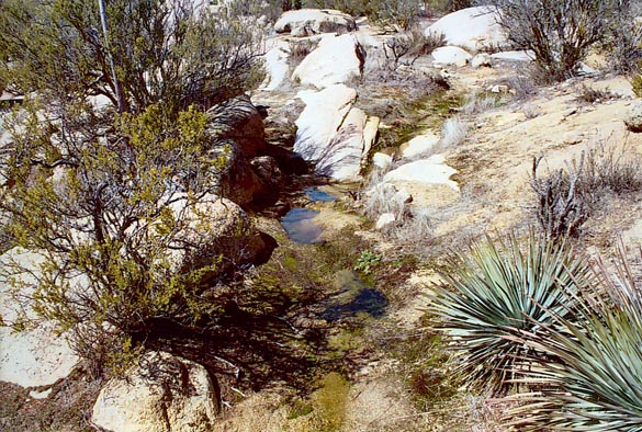
constructed wetlands (Fig. 1)
(Kadlec and Wallace, 2009).
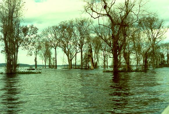
Island hydrology is important in countries such as India, which has [several union territories comprising] island archipelagos, including the Andaman and Nicobar Islands in the southeastern extreme of the Bay of Bengal, and the Lakshadweep Islands, off the coast of Kerala, in the Arabian Sea. These islands are largely inhabited by tribal peoples; in addition, they may be of strategic importance. The provision of safe drinking water for the local population and the management of coastal aquifers to control seawater intrusion due to excessive pumping of groundwater are two of the most pressing problems of island hydrology. Online hydrology has become a de facto necessity after global society embraced the Internet as early as 1994. Strictly speaking, online hydrology is not a content field; rather, online hydrology refers to the use of online capabilities and resources to practice hydrology on the web, and share information, remotely with oneself [making possible work off-station], and/or with colleagues, associates, and clients, and ultimately, if deemed appropriate, with the world at-large. Online hydrology consists of three types of applications:
Examples of static online hydrology applications are HTML-based systems such as ⇒ ponce.sdsu.edu. Examples of dynamic online hydrology applications are PHP-based systems such as ⇒ onlinecalc.sdsu.edu. Examples of media online hydrology applications are the Adobe Flash Media or Real Networks Helix streaming media systems such as ⇒ all.sdsu.edu. Economic hydrology is an emerging field that recognizes the intrinsic economic nature of water. Economic hydrology seeks to establish relations between the established uses of water, namely forest, range, agricultural, urban, ecological, and recreational, with the associated costs and benefits to society. Typically, in view of limited resources, a conflict between two uses would require a study to determine benefit/cost ratios. For instance, if groundwater depletion leads to the disappearance of neighboring springs, a study of economic hydrology may shed light onto the possible choices. Socioeconomic hydrology adds an important social component to economic hydrology. Socioeconomic hydrology seeks to establish relations between the established uses of water with the social costs and benefits therein. For instance, if excessive groundwater depletion in a basin or aquifer leads to an unsustainable situation, a study of socioeconomic hydrology may shed additional light on possible choices. An example of socioeconomic hydrology is the study of sustainable management of water in the Ojos Negros valley, Baja California, Mexico (Ojos Negros Research Group, 2003). Ecohydrology is an emerging field that recognizes the multidisciplinary nature of water, to encompass not only the traditional physics and chemistry, but also biology and ecology. It is no longer advisable to view hydrology as a narrow science that studies only the quantity of water available for human use. Rather, hydrology is increasingly being seen as satisfying all components of the ecosystem, including flora and fauna. Thus, ecohydrology studies the interactions between water and the flora and fauna of associated ecosystems (Fig. 2) (Ponce, 2006). The publication of several recent books attests to the importance of the emerging field of ecohydrology (Eagleson, 2002; Rodriguez-Iturbe and Porporato, 2004; Eamus, 2006; Harper et al., 2008).
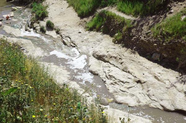
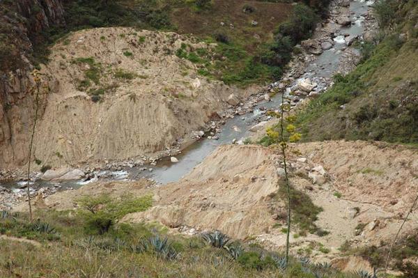
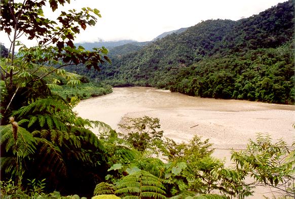
Hydrosedimentology deals with the relations between flowing water and the sediments that are naturally carried in suspension. Proper knowledge of water and sediment fluxes, including their temporal and spatial variations, is important in flood hydrology, agricultural hydrology, urban hydrology, reservoir hydrology, and lake hydrology, to name a few of the most salient. Studies of sediment transport are required for the assessment of sediment yield and reservoir life. Studies of aggradation and degradation of streambeds and river beds are required in the design of flood control works and related flood management schemes (Fig. 3). For instance, the Lane relation is an example of a sediment transport principle applicable to stream and river morphology (Ponce, 2011a).
Sediment-transport technology is the application of hydrosedimentology to engineering analysis and design. Sediment-transport technology includes the field, laboratory and computer techniques to calculate equilibrium sediment fluxes in flowing water, encompassing sediment production, transport, and deposition in catchments, streams, rivers, and estuaries. Nonequilibrium sediment transport is embodied in the techniques of sediment routing, aggradation, and degradation. As an example of sediment-transport technology, the Online Modified Einstein Procedure computes sediment load by size fractions, including bed load, suspended load, and wash load (Ponce, 2009a).
5.2 Expanding Areas
The areas currently covered and in need of expansion include
the fields [listed in the CBM]
with coverage index equal to
1. Drought hydrology
2. Baseflow hydrology
3. Low-flow hydrology
4. Arid-land hydrology
5. Agricultural hydrology
6. Urban hydrology
7. Rural hydrology
8. Mining hydrology
9. Mountain hydrology
10. Hard-rock hydrology
11. Experimental hydrology
12. Nuclear hydrology
Drought hydrology deals with the study of the intensity, duration, and frequency of droughts (Ponce, 2000).
Droughts are increasingly important in view of anthropogenic climate change, on both a regional and global scale.
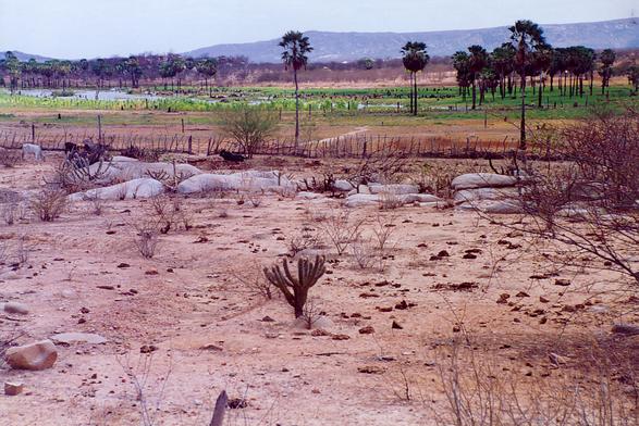
Deforestation, overgrazing, overagriculture [agriculture in marginal areas], salinization, desertification, and urban sprawl
may increase the magnitude and frequency of droughts (Fig. 4). In addition, global climate change may result in the aridization of the regional climate,
with consequent changes in drought characteristics.
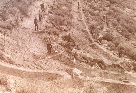
Drought hydrology studies are being carried out at NIH headquarters and in the Belgaum and Sagar Regional Centres. Baseflow hydrology is the exact opposite of flood hydrology, reflecting two sides of the same coin. Water that does not form part of flood water goes on to constitute baseflow. [This statement neglects changes in vadose-zone moisture, which are typically an order of magnitude smaller]. Current emphasis is shifting from floods to baseflow and baseflow augmentation (Ponce, 1989; Ponce, 1990). Increased groundwater replenishment and, consequently, baseflow replenishment, is now being seen as an effective way to mitigate floods. Thus, the importance of baseflow hydrology. Low-flow hydrology is related to baseflow hydrology, although with some notable differences. Baseflow hydrology is independent of season, while low-flow hydrology has a distinct seasonal flavor. Studies of low-flow hydrology are becoming increasingly important in societies that have all but exhausted their surface water resources, and are thus becoming increasingly dependent on groundwater. Since baseflow originates in groundwater flow, depletion of groundwater is bound to affect baseflow and, consequently, low flow. Low-flow hydrology studies are being increasingly considered in comprehensive assessments of groundwater sustainability (Maimone, 2004; Ponce, 2007). Arid-land hydrology deals with rainfall-runoff relations applicable to semiarid and arid lands, as opposed to subhumid and humid lands. It is well known that hydrologic relations differ across the climatic spectrum, from arid to humid. Arid-land hydrology is important because population migrations are such that they tend to concentrate on the dry side of the climatic spectrum. Urban and other types of development associated with population migration to arid lands imposes an additional burden on arid ecosystems. Examples are Southern California and Rajastan. Arid-land hydrology studies are being carried out in the Sagar Regional Centre. Agricultural hydrology deals with the solids produced as a result of irrigated agriculture. The solids are either: (a) suspended sediments, or (b) dissolved solids, the latter of various types, both natural and anthropogenic. Sediments are produced by sheet and rill erosion. Agricultural hydrology seeks to minimize the removal of sediments by sheet and rill erosion (Fig. 5).
Dissolved solids are produced by leaching. In arid regions, for instance, in Rajastan, agricultural operations must make every effort to remain in salt balance, i.e., to achieve a zero net increase of salt content in the soil, vadose zone, and/or groundwater. This requires the drainage and proper disposal of agricultural wastewaters, a difficult task which remains a worldwide challenge. Lack of timely removal and appropriate disposal of agricultural wastewaters, preferably to the ocean, eventually renders the soil in question, underlyling aquifers, and neighboring land too salty to be fit for human habitation (Fig. 16) (Pillsbury, 1981; Ponce, 2009b). Salinization implies unsustainability, which poses a transgenerational ethical dilemma (Ponce, 2011b). Urban hydrology deals with rainfall-runoff relations applicable to the urban environment, as opposed to the rural environment. Urban hydrology is important in order to provide adequate drainage to cities and suburban areas, in order to control and mitigate floods, while preserving water quality (Ponce, 2008). Urban development changes rainfall-runoff characteristics; therefore, the overall objective of urban hydrology is to cope with these changes in an optimal way. Hydrograph analysis is necessary to provide answers to pressing problems. Solutions include conventional drainage, detention and retention by ponds, microscale detention such as swales, and artificial replenishment of groundwater (Fig. 6).
Urban hydrology studies are being carried out in the Belgaum, Kakinada, and Patna Regional Centres. Rural hydrology is the exact opposite of urban hydrology. While urban hydrology typically focuses on water quantity, in rural hydrology the emphasis shifts to water quality. Due to its distributed nature, the rural environment does not lend itself readily to urban-type sewage collection and treatment. To compound the problem, in many rural areas, groundwater is increasingly being tapped to supply water for domestic use. Thus, there is the ever-present danger of contamination of rural water supplies with locally generated sewage stored in septic tanks and oxidation ponds. Alternative sanitation practices such as ecosanitation serve the purpose of reducing the risk of groundwater contamination (LaNeave and Ponce, 2011). The argument for the use of ecosanitation is based on the dictum: "Cleaner is not he who cleans more, but rather he who dirties less" (Ponce, 2012b). Mining hydrology is becoming increasing important due to the global resurgence of mining to support economic development around the world. Emerging countries are increasingly satisfying their need for raw materials by tapping mineral resources elsewhere. Mining operations, particularly those of the surface mining type, change the hydrology of entire regions, typically imposing severe demands on the surface-water quantity and quality. Additionally, open pits and subsurface mines interfere with the normal groundwater flow, causing changes in recharge and discharge. Moreover, mining companies may compete with agricultural and urban interests for the limited amounts of water, particularly in semiarid and arid regions (Fig. 7). Thus, mining hydrology seeks to determine optimum water management strategies and practices, with the aim of reconciling diverging sectorial views.
Mountain hydrology refers to the hydrology of mountain watersheds, streams, and lakes, as opposed to valley, coastal/deltaic and estuarine hydrology. It also refers to the processes of mass wasting (slope slides) and the increased sediment production and yield that often prevails in regions of steep topography such as the Andes and the Himalayas (Fig. 8). Unsteady flow in steep streams is characterized by the kinematic wave (Ponce, 1991). Under the right set of circumstances, this may lead to kinematic shocks and the flash floods normally associated with them (Ponce and Windingland, 1985).
Mountain hydrology studies are being carried out in the Guwahati and Jammu Regional Centres. Hard-rock hydrology refers to the unique hydrological problems of regions underlain by fractured rock aquifers; for example, that prevailing in the state of Karnataka and vicinity, in Southwestern India (National Institute of Hydrology, 1998). Storage in a fractured rock aquifer occurs primarily in the fractures. Although the rock matrix has significant porosity, its permeability is commonly so low that flow in the matrix is small relative to the flow in the fracture network. When test or production wells in these fractured materials are sampled, the samples represent water flowing in the fracture system rather than water present in the hard-rock matrix (Fig. 9) (Freeze and Cherry, 1979). Typically, the storage capacity of a fractured rock aquifer is considerable less than the storage capacity of an alluvial aquifer of comparable size (Ponce, 2012c). Thus, intensive groundwater capture usually leads to aquifer depletion, with associated socioeconomic consequences.
Hard-rock hydrology studies are being carried out in the Belgaum Regional Centre.
Experimental hydrology refers to the hydrology that is being carried out in the field or laboratory, as opposed to theoretical hydrology.
It includes both physical and numerical laboratories, since experiments can also be performed with the aid of a computer
(for instance, see
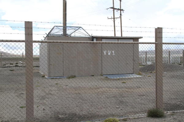
Victor Mockus, the creator of the famed SCS runoff curve number procedure, once mentioned [to the author] that in his opinion, there were three kinds of hydrologists: (1) Those that work only on the computer; (2) Those who also go to the field to gather data; and (3) Those who go to the field to gather data when it is raining. Mockus' group at the U.S. Soil Conservation Service in the 1940s through 1960s were hydrologists of the third kind (Ponce, 2002). Nuclear hydrology refers to the use of the environmental isotopes of water to study the source, transport, and fate of the various elements of the hydrologic cycle, including surface water, vadose-zone water, and groundwater. Nuclear hydrology provides the means to draw conclusions as to the source of contaminants and salinity, as well as age of groundwaters, sea-water intrusion, and other cause-effect problems. Nuclear hydrology studies are being carried out at the NIH headquarters in Roorkee. While NIH has extensive know-how and facilities in this field, there is a pressing need to expand the capabilities to include the measurement of isotopes of nitrogen, chloride, and sulphur [sulfur]. There is also a need to expand the laboratory's groundwater dating procedures to include the hydrogen-helium method.
5.3 Established Areas
The established areas in need of reinforcement, primarily by way of additional training for NIH staff, include selected
fields [listed in the CBM]
with coverage index equal to
1. Surface-water hydrology
2. Groundwater hydrology
3. Catchment hydrology
4. Snow hydrology
5. Glacier hydrology
6. Floodplain hydrology
7. Lake hydrology
8. Environmental hydrology
Surface-water hydrology is the preeminent field of hydrology, from which all other fields derive.
In these times of global water scarcity and regional water conflicts, an increased understanding of the hydrological cycle
is required to meet the challenge of sustainability.
Studies of evapotranspiration, infiltration, runoff, and streamflow
continue to be at the forefront of hydrologic research around the world.
In this regard, the Budyko approach to the water balance promises to further clarify the relation between rainfall and vegetation (Budyko and Drozdov, 1953).
Does rainfall produce vegetation? Or, conversely, does vegetation produce rainfall? (Fig. 11).
The answer to this question is rooted in the fundamental
role of albedo in controlling the Earth's near-surface energy balance and,
consequently, in determining the water balance (Ponce et al., 1997).
Anthropogenic climate change will affect surface water; therefore, the impact of climate change on water resources
constitutes a worthwhile research endeavor. Changes in intensity, depth, duration, and frequency of precipitation
will determine runoff availability and, consequently, its impacts to society, in the medium and long term.
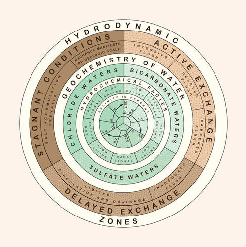
Surface-water hydrology studies are being carried out at NIH headquarters and at all Regional Centres. Groundwater hydrology is the field of hydrology that deals with the water existing in underground reservoirs. While surface water is totally replenishable in the short term, with a global average of 11 days (L'vovich, 1979), a similar statement does not apply to groundwater. Groundwaters have a wide range of ages, varying from days to years to centuries to millennia. The global replacement of all groundwater has been estimated at 5,000 years (L'vovich, 1979). For depths within 2,000 m of the Earth's surface, groundwater is replaced every 1,400 years (World Water Balance, 1978). Drainage conditions deteriorate with increasing depth, the movement of water slows down, and the salinity concentration increases (Fig. 12) (Chebotarev, 1955). The deeper the groundwater, the older and saltier it is likely to be (Freeze and Cherry, 1979). Thus, excessive groundwater exploitation is not only a problem of water quantity but also of water quality.
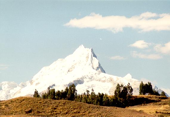
Groundwater depletion due to excessive pumping is a pervasive practice around the world, including India. Studies are urgently needed to assess the sustainability of groundwater reservoirs. It is noted that the traditional concept of safe yield, which is based solely on hydrogeology, is now being retired and replaced by the broader concept of sustainable socioeconomic yield (Bredehoeft, 1997; Sophocleous, 1997; Ponce, 2007; Ponce, 2010a; 2012c). Groundwater hydrology studies are being carried out at NIH headquarters and at the Belgaum, Kakinada, Patna, and Sagar Regional Centres. Catchment hydrology studies the relation between rainfall and runoff in catchments, watersheds, and basins. This is a fundamental hydrologic endeavor, and one that is poised to underpin all other processes. An important aspect of catchment hydrology is the determination of the catchment water balance, which helps in understanding hydrologic processes and enables a more precise water accounting. In this respect, the L'vovich water balance stands out preeminently among water balance methods (L'vovich, 1979; Ponce and Shetty, 1995a; 1995b). By relying on the concept of catchment wetting, the L'vovich method circumvents the double accounting of evapotranspiration which plagues conventional water balance methods (Ponce, 2010b). Catchment hydrology studies are being carried out at NIH headquarters and at all Regional Centres. Snow hydrology refers to studies of snowmelt in relation to catchment hydrology studies in snow-covered mountainous regions. The objective is to ascertain the role that snowpack plays in storing precipitation for later release as snowmelt. Snow hydrology studies are important in regions where snowfall is a substantial component of precipitation, and where snowpack covers large portions of mountain watersheds. Despite the vital role of snow hydrology in Indian water resources, limited studies have been performed at NIH in this field. Thus, there is a need for NIH to sharpen its capabilities in snow hydrology. Snow hydrology studies are being carried out at the Guwahati and Jammu Regional Centres. Glacier hydrology refers to the study of glaciers, their origin, growth, and recession (Fig. 13). In the past 30 years, since the onset of global climate change, attributed by many to anthropogenic causes, glacier hydrology has taken a renewed importance. It has now become necessary to monitor glacier advancement or recession on a long-term basis, with the aim to document the effects of global climate change on Indian water resources.
Glacier hydrology studies are being carried out at the Jammu Regional Centre. Floodplain hydrology refers to the study of floods in relation with the associated floodplain. Historically, human societies have tended to concentrate in the flood plain. According to principles of fluvial geomorphology, rivers have a tendency to overflow their banks every 2 to 5 years. Thus, flood plains become important from the standpoint of flood hazard, flood proofing, flood damages, and flood management. Moreover, floods serve as active agents for nutrient replenishment of the floodplain; thus, they have some positive natural features. Increasingly, the emphasis of flood hydrology has been shifting from conventional flood control, which relies primarily on structural measures, to interdisciplinary flood management, with focuses on nonstructural measures. In many cases, particularly in humid and hyperhumid regions, nonstructural measures such as flood proofing is an effective tool of floodplain management (Fig. 14).
Floodplain hydrology studies are being carried out at the Guwahati and Patna Regional Centres. Lake hydrology refers to the study of lakes, their origin, properties, and aging process. Increased rates of lake sedimentation are threatening the survivability of lakes in many countries, including India. Thus, studies of lake hydrology and lake sedimentation are increasingly needed to better understand the aging processes, and to identify and implement the appropriate corrective measures. Lake hydrology studies are being carried out at the Jammu, Kakinada, and Sagar Regional Centres. Environmental hydrology refers to the study of hydrology when viewed in terms of all the components of the ecosystem, including water, sediment, nutrients, flora, and fauna (Fig. 15). Environmental hydrology differs from ecohydrology in its broadly defined interdisciplinary flavor, reaching beyond ecology to encompass anthropological, socioeconomic, political, and institutional aspects. Environmental hydrology is important in this era of wide recognition of human's stewardship of the environment. The aim is to develop the appropriate decision-making tools to manage the natural environment to meet the challenge of sustainability. Thus, the need for sharpening NIH's focus, role, and activities on sustainable water systems management.
Environmental hydrology studies are being carried out at NIH Headquarters and at the Belgaum, Guwahati, Jammu, Kakinada, and Patna Regional Centres. 6. TRAINING PROGRAMME
The training programme seeks to train NIH scientists to upgrade their skills and capabilities to enable them
to better accomplish the mission and objectives of NIH.
Three prioritized components are recognized:
The details of the training programme will be formulated as part of Task B (Third Report), to be completed after the Consultant's second field visit.
7. MISSION AND OBJECTIVES REVISITED
At the request of the World Bank, the Consultant has reviewed the Mission and Objectives stated in the Baseline Document,
in light of recent technological advances. The following draft of a revised
Mission and Objectives is offered for consideration by NIH.
Mission and Objectives
The principal mission of the National Institute of Hydrology, Roorkee, India (NIH) is to advance, develop and maintain
world-class knowledge and expertise
in the hydrological sciences and other water-related disciplines, for the purpose of assisting the Government of India and other stakeholders
in the rational use of the water resources of the country, which comprises twenty-eight states and seven union territories. Intrinsic to the principal mission of NIH is the recognition that water is a precious resource,
to be appropriately managed for sustainability.
Other missions of the Institute are:
The institution accomplishes its mission by maintaining a selected staff of professional scientists
with the appropriate level
of education, training, and experience to conduct applied research and development in the hydrological sciences and other water-related disciplines.
In addition, the Institute strives to provide the
necessary facilities, including physical, computational, and other laboratories, and the required hardware, software and IT support
to adequately assist its staff in the fulfillment of their professional duties.
The objectives of NIH are the following:
8. CONCLUDING REMARKS
A benchmarking exercise is carried out for the benefit of the
National Institute of Hydrology (NIH), Roorkee, India. Peer benchmarking
and content benchmarking are performed.
Under peer benchmarking, a group of ten (10) peer institutions
around the world are identified, with their strengths singled out
for study and possible emulation. Under content benchmarking, a comprehensive list of
one hundred (100) hydrology subfields are identified, whereupon
NIH's activities are rated in terms of intensity of coverage and need for
increased/decreased emphasis. Peer benchmarking has identified current
trends and emerging fields for further consideration. Content benchmarking
has produced a list of emerging, expanding and established areas, where
additional resources, in terms of training and equipment, are advisable.
This report is the second of four reports prepared under the project
"Benchmarking, Technological Upgradation and Capacity-Building Programme of the
National Institute of Hydrology, Roorkee, India."
A first report entitled Inception Report was completed on 14 May 2012.
The second report is the present report, entitled "Benchmarking Exercise - Task A."
A third report, to be completed after the second field visit planned for July 2012, will cover the training of NIH personnel (Task B).
A fourth report (in draft and final form) will cover all aspects, including the strengthening of NIH with equipment (Task C).
9. APPENDICES
REFERENCES
Bredehoeft, J. 1997. Safe yield and the water budget myth.
Editorial, Ground Water, Vol. 35, No. 6, November-December, 929.
Budyko, M. I., and O. A. Drozdov, 1953. The laws of water cycle in the atmosphere. Bulletin of the U.S.S.R. Academy of Sciences, Series: Geogr., 4, 167-170.
Chebotarev, I. I. 1955. Metamorphism of natural waters in the crust of weathering. Geochimica et Cosmochimica Acta, 8, 22-48, 137-170, 198-212.
Dee, N., J. Baker, N. Drobny, K. Duke, I. Whitman, and D. Fahringer. 1973.
An environmental evaluation system for water resource planning. Water Resources Research, Vol. 9, No. 3, June, 523-535.
Eagleson, P. S. 2002. Ecohydrology:
Darwinian Expression of Vegetation Form and Function. Cambridge University Press.
Eamus, D. 2006. Ecohydrology: Vegetation function, water and resource management.
Csiro Publishing.
Freeze, R. A., and J. A. Cherry. 1979. Groundwater. Prentice-Hall, New Jersey.
Harper, D. M., M. Zaleski and N. Pacini. 2008. Ecohydrology: Processes, Models And Case Studies.
CABI.
Kadlec, R. H., and S. Wallace. 2009. Treatment wetlands. CRC Press, Second edition.
LaNeave, J. C., and V. M. Ponce. 2011. The facts about dry ecological latrines. Online article.
Leopold, L. B., F. E. Clarke, B. B. Hanshaw, and J. E. Balsley. 1971.
A procedure for evaluating environmental impact. U.S. Geological Survey Circular 645, Washington, D.C.
L'vovich, M. I. 1979. World water resources and their future.
Translation of the original Russian edition (1974), American Geophysical Union, Washington, D.C.
Maimone, M. 2004. Defining and managing sustainable yield. Ground Water, Vol. 42,
No. 6, November-December, 809-814.
Meinzer, O. E. 1927. Plants as indicators of ground water. U.S. Geological Survey Water Supply Paper 577.
Mitsch, W. J., and J. G. Gosselink. 2011. Wetlands. John Wiley and Sons, Third edition.
National Institute of Hydrology, India. 1998.
Hydrological problems of hard rock region: A State - of - Art Report.
National Institute of Hydrology, India. 2012. Current status and working of National Institute of Hydrology. Baseline Document,
DFID Grant to NIH for Benchmarking, Technological Upgradation and Capacity Building Programme.
Ojos Negros Research Group. 2003. Sustainable management of water in the Ojos Negros valley, Baja California, Mexico. Online report.
Pillsbury, A. F. 1981. The salinity of rivers. Scientific American, Vol. 245, No.1, July, 54-65.
Ponce, V. M., and D. Windingland. 1985. Kinematic shock: Sensitivity analysis. ASCE Journal of Hydraulic Engineering, Vol. 111, No. 4, April, 600-611.
Ponce, V. M. 1989. Baseflow augmentation by streambank storage: Literature review and annotated bibliography. Online report.
Ponce, V. M., and D. S. Lindquist. 1990. Management of baseflow augmentation: A review.
Water Resources Bulletin,
Vol. 26, No. 2, 259-268.
Ponce, V. M. 1991. The kinematic wave controversy. ASCE Journal of Hydraulic Engineering, Vol. 117, No. 4, April, 511-525.
Ponce, V. M., and A. V. Shetty. 1995a. A conceptual model of catchment water balance: Formulation and calibration. Journal of Hydrology, 173 (1995), 27-40.
Ponce, V. M., and A. V. Shetty. 1995b. A conceptual model of catchment water balance: Application to runoff and baseflow modeling.
Journal of Hydrology, 173 (1995), 41-50.
Ponce, V. M., A. K. Lohani, and P. T. Huston. 1997. Surface albedo and water resources: Hydroclimatological impacts of human activities.
ASCE Journal of Hydrologic Engineering, Vol. 2, No. 4, October, 197-203.
Ponce, V. M. 2000. Characterization of drought across climatic spectrum. ASCE Journal of Hydrologic Engineering, Vol. 5, No. 2, April, 222-224.
Ponce, V. M. 2002. Hydrologists of the third kind. Legacy tale.
Ponce, V. M. 2006. Impact of the proposed Campo landfill on the hydrology of the Tierra del Sol watershed: A reference study. Online article.
Ponce, V. M. 2007. Sustainable yield of groundwater. May. Online report.
Ponce, V. M. 2008. Q&A on the return period to be used for design. Online article.
Ponce, V. M. 2009a. Total sediment discharge by the Modified Einstein Procedure. Online calculator.
Ponce, V. M. 2009b. Sustainable runoff for basin salt balance.
Online article.
Ponce, V. M. 2010a. Who owns the groundwater? Online article.
Ponce, V. M. 2010b. Water balance using catchment wetting. Online calculator.
Ponce, V. M. 2011a. The Lane relation revisited. Online article.
Ponce, V. M. 2011b. Sequestering all runoff. Online video.
Ponce, V. M. 2012a. Inception Report. Benchmarking, Technological Upgradation and Capacity Building Programme of the
National Institute of Hydrology, Roorkee, India, 14 May 2012.
Ponce, V. M. 2012b. Dry ecological latrines. Online feature.
Ponce, V. M. 2012c. Thompson Creek Groundwater Sustainability Study. Online report.
Ponce, V. M., and [the Late] A. B. Palaniappan. 2012. Facets of Hydrology. Online feature.
Rodriguez-Iturbe, I., and A. Porporato. 2004. Ecohydrology of Water-controlled Ecosystems : Soil Moisture and Plant Dynamics. Cambridge University Press.
Sophocleous, M. 1997. Managing water resources systems: Why "safe yield" is not sustainable. Editorial, Ground Water, Vol. 35, No. 4, July-August, 561.
Spendolini, M. J. 1992. The Benchmarking Book. American Management Association, New York.
Vernadsky, V. I. 1926. The Biosphere. (Original in Russian, English translations in 1986 and 1998).
World Water Balance and Water Resources of the Earth. 1978. U.S.S.R. Committee for the International Hydrological Decade, UNESCO, Paris, France.
|
| 120622 |
